

An eye-opening time lapse video illustrates global deforestation rates.
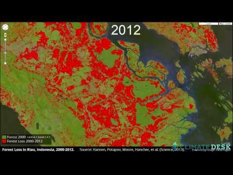
Using over 650,000 satellite images researchers have put together a global map of deforestation rates from 2000 to 2012. A collaborative effort between NASA, Google, and the U.S. Geological Survey, the map shows that over 888,000 square miles of forest were lost in the last twelve years. In this video, Matthew Hansen, lead researcher at the University of Maryland, points out the huge effect humans have had on the environment.


